2026-10-16 · 11 min read · Bay Area
How Can Buyers Investigate Lot Lines and Easements?
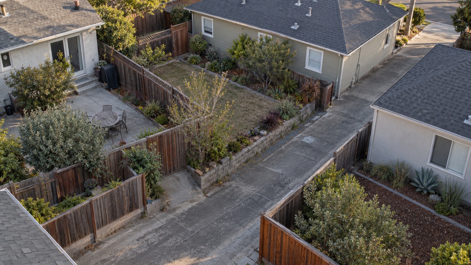
How can buyers investigate lot lines and easements?
Start with the deed or legal description, preliminary title report, recorded easement documents, and any survey the seller has. Walk the property to identify fences, paths, utilities, and structures that may raise a question. If the exact boundary or easement location matters to your decision, ask a licensed land surveyor and a title or real estate attorney for the right review. A web parcel map and a fence are clues, not a boundary conclusion.
I am Kate Fomina, a broker at Crypton Realty in Alameda. I help buyers gather the records and frame the questions before an offer or investigation deadline. I cannot locate a legal boundary, certify access, or interpret an easement's legal effect. The surveyor, title company, local authority, and attorney handle those conclusions. The DRE surveyor guidance explains why the boundary question needs a qualified professional.
The image above is a fictional editorial photograph. It is not a real parcel, survey, legal description, easement, client property, or boundary opinion.
Why should lot lines be checked before a plan depends on them?
A buyer may want to replace a fence, add a structure, change a driveway, or use a side yard. Those plans depend on more than what appears to be inside the fence. The recorded description, survey evidence, local rules, and rights held by others may affect what can be done. Ask early if a boundary question changes your willingness to buy or the price you would offer.
Do not treat a listing's lot-size figure as a field measurement. It may be drawn from records prepared for another purpose. The U.S. Geological Survey discussion of GIS and surveys explains that GIS parcel maps are reference tools and do not carry the legal authority of survey products. That distinction is useful when an online outline appears to cut through a fence or building.
My Bay Area buying guide treats property documents and physical conditions as separate checks. A boundary concern needs both kinds of evidence.
Which records should a buyer request?
Ask for the current preliminary title report with the documents behind any relevant exception, the deed and legal description, recorded maps or plats available through the title company or county recorder, and any prior survey the seller can provide. Ask whether the seller has agreements about a driveway, fence, utility line, drainage route, or access. A disclosure or old survey is a lead to investigate, not a guarantee of current conditions.
The California Department of Real Estate's buyer guide describes the preliminary title report as a search that can identify liens and encumbrances. Ask the title officer to provide the recorded document for an exception rather than relying only on its short label. A reference to an easement without the instrument may leave the key location or permitted use unclear.
My disclosure-package guide helps buyers compare summaries with attachments. Keep a list of missing maps, amendments, and signatures.
What does the preliminary title report tell you about an easement?
It can flag a recorded right or exception that needs further reading. Ask the title officer for the full recorded instrument and any map it references. Identify which parcel benefits, which parcel is burdened, what activity is described, and whether the document has a location exhibit. Do not assume every easement appears as a simple line on a parcel map or that a broad title exception defines exact ground limits.
The DRE Reference Book chapter on title discusses recorded and potentially unrecorded property interests, including visible clues such as a pathway or sewer line. A title officer can explain the report and coverage questions, while an attorney can interpret a disputed right. Ask those professionals to resolve ambiguity before you rely on a conclusion.
Keep the title report date visible. If a newer report arrives, review any changed exception list and ask why it changed.
How should you read the easement document itself?
Look for the parties, recording information, legal descriptions, purpose, location, access terms, maintenance duties, and any restrictions or termination language. Put each unanswered point in a written question for the title company or attorney. A document may refer to an exhibit or earlier agreement that is missing from the package. Ask for it.
Do not infer that a utility easement permits parking, storage, or construction because it crosses a part of the yard. Do not infer that a shared driveway agreement guarantees any particular width or repair arrangement without reading the text and locating it on the ground. These are legal and surveying questions.
Ask the surveyor whether the recorded description can be plotted reliably and what additional records are needed. Ask the attorney how the document affects the use you have in mind.
Can fences, walls, and landscaping show the boundary?
They show where someone placed improvements. They do not prove the legal line. Walk the entire perimeter and note a fence that changes direction, a retaining wall, a neighbor's structure close to the apparent edge, or landscaping that crosses an apparent line. Photograph the location and avoid stating that an encroachment exists until a qualified professional reviews it.
A visible occupation pattern may still matter. The DRE title chapter notes that physical inspection can reveal use or features that a records search does not fully explain. Ask the surveyor where the recorded line lies and an attorney about any legal consequence of a mismatch. Do not move a fence or confront a neighbor based on a phone map.
My second-showing guide gives buyers a way to revisit exterior details calmly. Bring the recorded questions with you.
What is the role of a licensed land surveyor?
A surveyor can research the record, evaluate monuments and field evidence, and explain the scope of work needed to locate a line or easement. The DRE Bulletin on hiring a land surveyor warns against having an unlicensed person represent a property boundary as a survey conclusion. Ask about the professional's license, proposed deliverable, timing, and whether a record survey or other filing may be needed.
Not every boundary question requires the same product. A prior survey may help, but it can be old, incomplete, or prepared for another purpose. Ask the surveyor whether it is reliable for your intended decision. A real estate agent can coordinate access and documents, but should not draw a line on the ground and call it verified.
Schedule the work against contract deadlines. Field research and access may take longer than an online map lookup.
How do shared driveways and access paths change the review?
Identify the actual route used to reach the home, garage, parking, or rear area. Ask whether that route lies on the parcel or crosses land owned by another party, and whether a recorded or other legal right supports it. Read any access or maintenance agreement. A paved path does not by itself establish the right to use it, and a recorded right may not describe who pays for repairs in the way a buyer expects.
Ask a title officer and attorney to review the documents. A surveyor can locate the route and boundary if location matters. If a gate, slope, retaining wall, or narrow turn affects practical access, visit the property and ask a qualified professional about the physical question. Keep legal access and physical usability as separate questions.
If the answer affects financing or insurance, send the documents to the lender or insurer and ask for their requirements. Do not assume a previous owner's arrangement transfers unchanged.
What should you ask about utility or drainage easements?
Look for visible poles, boxes, meters, drains, channels, or lines and compare them with the recorded documents. Ask the utility provider, local agency, or title officer for records relevant to a question. A buried line may not be visible, and a visible line may have a separate agreement. Do not dig or plan a new structure based on a sketch in a listing packet.
Ask what access a utility or other holder may need and whether the recorded right affects a proposed fence, tree, addition, or grading. A surveyor can help locate a described strip. The holder or local authority can answer operational or permit questions. An attorney can interpret disputed rights and duties.
For a drainage feature, ask a qualified inspector or engineer about physical performance. The existence of an easement does not prove the system works or that its maintenance obligations are understood.
How do you test a future building or fence idea?
Write the plan in plain terms: where, how large, and what use. Then ask the surveyor to locate the relevant boundary or easement area, the local planning or building department about permits and setbacks, and an attorney about any recorded restriction. If the property has an association, read its governing documents and ask about approval. Each professional answers a different part of the question.
Do not rely on a seller's comment that an addition or fence should be allowed. Do not treat a permit issued for earlier work as approval for your new plan. Costs and timelines need estimates from the relevant professionals. Keep the plan conditional until written answers are available.
My Pre-Offer Five helps connect condition, documents, price, financing, and timing. A property feature that is central to your plans deserves an investigation date, not a vague note for after closing.
What if documents and physical evidence disagree?
Write down the conflict precisely. For example, the recorded map may show a strip along one edge while a fence stands elsewhere, or a title exception may name a path you cannot identify. Give the full record, photos, and your question to the title officer and surveyor. Ask an attorney if the disagreement affects legal use, ownership, or a contract decision.
Do not choose the version you prefer or state that the neighbor is wrong. A mismatch may have several explanations, including an old map, later work, a missing document, or an inaccurate assumption about where the line is. Only the appropriate investigation can sort it out.
Track who is waiting for which record and by what date. If a contingency deadline approaches before the answer arrives, ask your agent and attorney about the written options.
When should boundary questions be raised in the transaction?
Raise a material question before making an offer when possible. Some documents may become available only after an offer is accepted, so identify the records and professional work you would need during the investigation period. Put requests and deadlines in writing through the transaction team. The DRE surveyor guidance helps explain why field work may take more than an online lookup. Do not assume a missing easement exhibit is immaterial.
The DRE buyer guide encourages reading transaction documents and asking questions before signing. Your signed agreement determines actual deadlines and options. A title objection, inspection contingency, or requested extension needs review under those terms. An attorney should advise on legal rights or a dispute.
My buying process guide shows why early document review helps the later financing and closing steps.
Can an online parcel map settle a boundary question?
No. It is useful for orientation and for identifying a parcel number or records to request. The USGS discussion of GIS explains that those maps are reference representations, not legal survey products. When the exact line matters, use recorded evidence and a licensed surveyor. Do not measure a setback with a screen ruler.
Does title insurance replace a survey or legal review?
No. Ask the title company what its policy would and would not cover and whether an exception applies. The DRE title chapter helps frame why title coverage and a survey answer different questions. A survey locates or evaluates physical boundary evidence, while a title officer explains policy and record information. An attorney can advise on a disputed right. Do not assume the preliminary report promises coverage for every visible condition.
What should you do next?
Collect the title report, deed description, maps, easement instruments, seller records, and any prior survey. The DRE buyer guide explains why title records deserve review. Walk the site and list features that do not match your understanding. Decide whether the exact line or right matters to your plans. If it does, ask a licensed surveyor, title officer, local authority, and attorney the specific questions before your decision deadline.
Read my Santa Clara County buying page for the broader search process. If you are evaluating a particular lot, contact me with the title exception or map reference you want to investigate. This is general information, not surveying, title, legal, zoning, engineering, construction, lending, or financial advice. The recorded documents and qualified professionals control the details.